Here are pictures from the last two weeks we were on the trail. I did narrow them down, but there's still a lot. :)

The railroad tracks are the official Maryland/Pennsylvania state line even though there was no sign.

Just a few hundred yards from the railroad tracks we passed the Mason Dixon line.

This sign says it all, although we were already 4/5ths done with the state when we passed this sign! It is amazing how one area can be so concentrated with one thing, rocks in this case. Did God end up with a ton of extra rocks and just decide to toss them all in one place? We thought it was probably related to the latitude of PA and the elevation of the ridges, being the perfect area for a lot of freeze and thaw cycles over the ages.

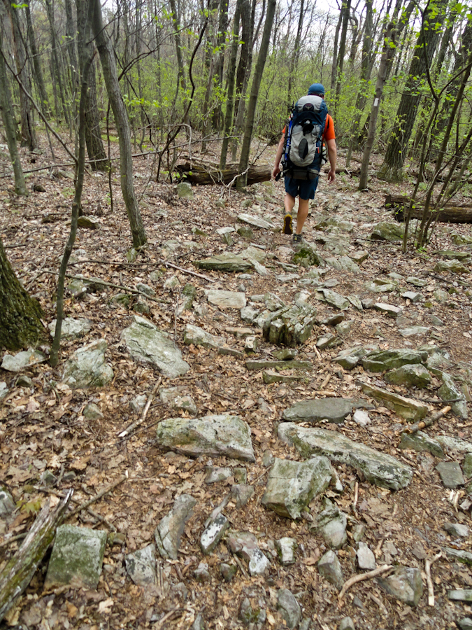
There were way more rocks in PA than not.

Andrew running up the rocky section.... as usual! The sections of big rocks were much easier to deal with than the sections with hundreds of small sharp rocks sticking straight up out of the ground.

Not rocky.... YEA! These sections never lasted long enough.

World's biggest rock cairn. A product of Pennsylvania's abundance of rocks.

One of the better PA views, looking out at state forest land.

Rocks, rocks, rocks.

Carriage trail.... YEA!

Uhhhh, where's the trail, dude?

And the rocks just keep on coming!

Okay, this is getting rock-diculous.

Crossing a stile over a fence into pasture land.

The "Taj Mahal" privy, a ridiculously oversized outhouse, that must have been a testament to how awesome the hiking club was that built it? Just open space and a typical "one-holer." I'd rather they spent the time doing trail maintenance. The light colored spot near the door is from a porcupine chewing on the plywood. Andrew heard it gnawing away in the middle of the night, so he grabbed the camera and his headlamp and got some photos.


Andrew chased the porcupine out from under the privy in an attempt to convince him his painted plywood addiction was a bad idea. It immediately went up a large oak tree, and was greeted by a gray squirrel. There was a brief but tense standoff, until the porky decided to advance, and the squirrel retreated.

The Darlington shelter, barely larger than the nearby "Taj Mahal" privy.

Pasture walking, coming off one ridge, and heading to the ridge in the foreground.

One of four snakes we saw.

Looking down towards Duncannon.

The Susquehanna River alongside the town of Duncannon.

Crossing more...... Rocks.
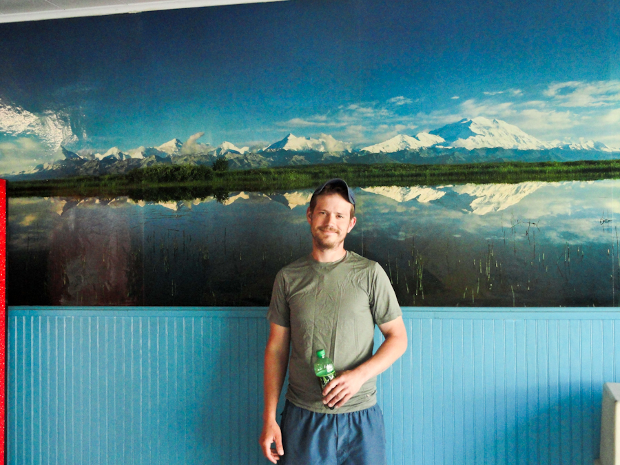
A beautiful panorama of Denali found in the laundry mat in Duncannon.

The Doyle hotel in Duncannon, where we enjoyed an awesome meal, and spent the night. It was built during the late 1800s. What a magnificent building!

Rhododendron forest resembling something from the Smokies!

This is part of the reason the trail is described as "the long, green tunnel."

One of the nicer shelters we stayed in, where we were fortunate enough to meet Gus, a great trail friend! It was so well maintained. The maintainer seemed to be here almost every day keeping things up and checking on everything.

Hanging flowers at a shelter!?!? Are you kidding!?!?


Just so we know our place on the totem pole.

This was the "mansion", that is now a hiker hostel, but not open for the season yet.

Entering the "rock maze", a section of large boulder-size rocks on top of a peak.


More pasture walking between ridgelines.

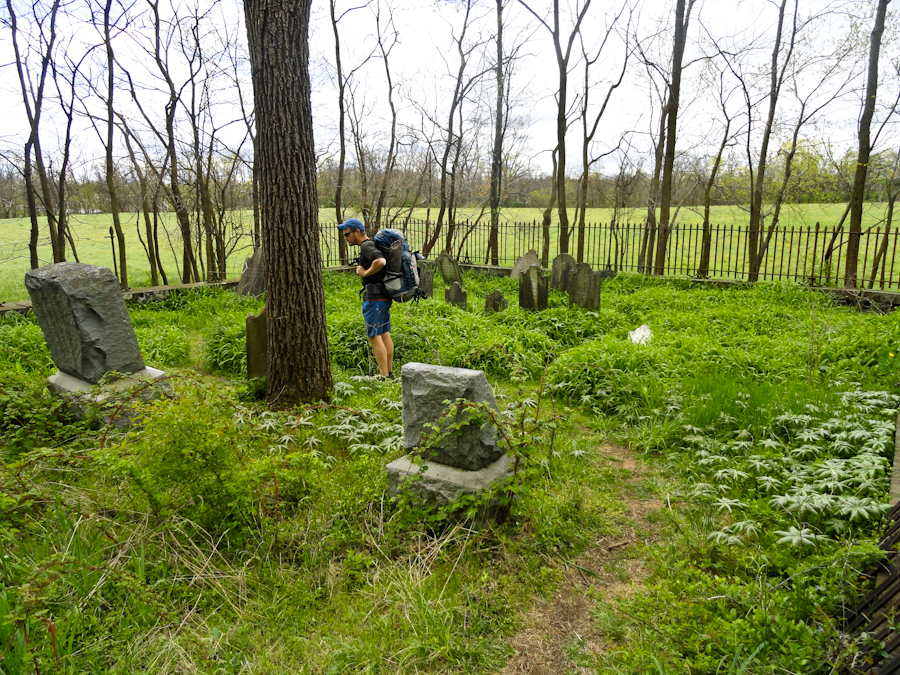
The oldest cemetery either one of us believe we have ever stood in! One marker showed a death year of 1737, with an age of around 40!


Walking by the cows! Mooooo

Our wonderful three person tent. A fantastic addition to our backpacking comfort.

Rocks, followed by...

Rocks, followed by...
Rocks, followed by....

The largest burl we've ever seen!!!! Isn't it cool!

Some interesting patterns in the bark of this tree.

The trail heads right through down town Port Clinton, a small town of less than 300 people.

A spray-painted map under an I-81 overpass, should we happen to forget where we where.


Early morning sunshine burning off the fog.

A view called "The Pulpit."

A view as close to McAffee Knob as we got this trip.


Minimal material used to construct a bridge.

Tired of saying rocks, now going to call them "stones."


Another of our scaled friends....a four foot long black snake.

The may-apple forest.

The eye behind the camera finally lets Andrew take a picture of her! We decided we'd title this trip "Andrew Hikes the AT" since that's 90% of the pics we have with either of us in them.

A freshly burned area. Not sure how it started, but it was not prescribed, and we were told by other hikers that it had been extinguished just two days before our arrival! This was one of three freshly burned areas we hiked through.

One of our few timer shots with us both. The ridge we were on was very similar to the ridge in the background.... FLAT! So all in all the rocks added some challenge.

More stones.

One of several knife-edge ridges we traversed.

A view worth detouring for.

More of guess what...?

Cool creek filtering through the trees before joining the creek bed.


Loving the sunshine!

Very similar to most of our views, looking down on the farmland about 1000 feet below us.

The Allentown Hiking Club shelter. Where we met several interesting people and shared lots of good conversation.

OOOOO, look! A camera strap!


Quick detours up to spots like this often afforded a welcome cool breeze as well as a nice view.

A bad place to lose your footing!

Rocksylvania earns it's name yet again!


Andrew's feet got this dirty each and every day! He was wearing his (non-waterproof) running shoes this time, which he was very pleased with, but the dust passed right through to his feet. It was funny getting to a shelter and seeing people's reaction when he would pull off his shoes and socks to let things air out. He called it his "natural blister protection!"

This extremely steep rocky ascent was coming up the ridgeline above the Palmerton Superfund Site. A zinc smelter operated on the other side of this ridge from the 1880s to the 1980s, completely deforesting the ridge with it's pollution. When it was closed it was taken over by the EPA for cleanup.

We really enjoy scrambling up rocky ledges like this, but we were forced to carry the whole days water (about a gallon and a half, which is twelve extra pounds!) because of a lack of springs for seventeen miles after the shelter we'd left this particular morning. Normally we each carry a 20 oz. bottle of water from spring to spring. We've found we can "camel up" at a spring, then go up to about seven or eight miles with just 20 oz. if you pace yourself right, and it's not too hot to go dry for the last two miles or so. The extra weight made this particular ascent a little more work.


The large flat rocks were much easier to walk on than these little guys! It's hard to find a good place to set your foot where you don't have a sharp edge digging in somewhere. Days with lots of this ended with the dreaded "hamburger-feet" feeling.


The storm Andrew is looking back at caught up to us shortly after this photo. We were about 18 miles into a 21 mile day, and were lucky to get off the very sharp ridge we were on, right before things got really ugly. It was very windy, with a fair amount of lightning, but it only sprinkled lightly until we got to our campsite for the night. We had a photo finish setting up the tent as it was really starting to precipitate, and got just a little wet before we dove into the tent and the storm really let loose. It was quite a thunderstorm that unleashed some real fury for most of the night.

Passing through another burned area, that looked like last years burn.

Big flat stepping stones.... Not so hard on the feet, but a little harder on the ankles.


More cool rhododendrons.


The orange on Andrew's back is his wet t-shirt from setting up the tent the night before.

This is what we figured was our least favorite style of stepping stones.

The view looking down on the Delaware River. Notice Andrew is in his rain jacket... We got a very nice steady rain for the last eight or so miles of our last day hiking. It was our only day to walk in more than just a sprinkle. We kept waiting on a good rain day, which neither of us mind, and it was a great day to have it happen!

And Gus! How awesome it was to meet such a cool guy that drove an hour each way to come and get us, then take us back home to have a fantastic family dinner with his folks. We've heard several experiences from other hikers, about getting taken home by strangers and getting fed a wonderful home cooked meal. The people you meet on the trail is one of the best things about the whole experience. We had shared a great night laughing and conversing with Gus at a shelter, and he mentioned he'd come and get us if we called... But talk about hospitality!
Gus if you're reading this, thanks again man!